


-
- Current Groundwater News
- Groundwater Basics
- Groundwater Management
- Groundwater Classification
- Groundwater in Texas
- Monitoring and Data
- Agricultural Resources
- Resources for Small Communities
- National Groundwater Awareness Week in Texas
- Groundwater White Papers
- Groundwater Frequently Asked Questions (FAQs)
Water Wells
A water well is a hole drilled into an aquifer with a pipe, screen, and pump to pull water out of the ground. There are many different types and uses of wells. Public wells supply drinking water to municipalities. Private or domestic wells can be used for a variety purposes, such as irrigation, drinking water and industrial uses.
Well Basics
The Groundwater Foundation's Wells and How they Work has more information on well construction. Wellowner.org provides information regarding Water Well Basics and offers free online Well Owner Lessons.
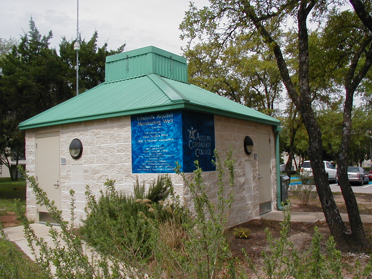 ACC Edwards Aquifer Monitoring Wellhouse; photo courtesy of Kathy McCormack (TCEQ)
The inside of a water well can be fascinating, as seen in a 40-second video taken with a camera lowered down Austin Community College's Edwards Aquifer monitoring well. To watch the video, click on the image (on the left side of this page) of the Northridge Campus building which houses this well and download the .wmv file. The numbers in the center of the video indicate the depth in feet below the land surface. Video provided by GeoCam, Inc. for Austin Community College.
Statewide Water Well Databases
Six searchable, online water well databases provide a wealth of data on the water wells that exist in Texas:
- Created in 2001, the joint Texas Water Development Board (TWDB) and Texas Department of Licensing and Regulation (TDLR) Submitted Drillers Reports (SDR) Database includes over 650,000 well reports and over 230,000 plugging reports submitted by water well drillers. An explanation of the Reports Toolbar is available.
- For wells drilled as early as 1820, the TWDB Groundwater Database (GWDB) includes over 140,000 water well records. An explanation of the Reports Toolbar is available.
- Data from both the GWDB and SDR Database can be viewed in the TWDB Groundwater Data Viewer, an interactive map application. A Quick Reference Guide for this system is available.
- The Texas Commission on Environmental Quality (TCEQ) Water Well Report Viewer allows users to geographically locate and view copies of at least one million scanned water well reports submitted by drillers since 1960. A User Guide for this Viewer is available.
- For public drinking water sources, the TCEQ Source Water Assessment and Protection Viewer displays not only water wells and surface water intakes, but also provides information such as well depth and drilling date. A User Guide for this Viewer is available.
- The TCEQ Texas Drinking Water Viewer displays detailed information on public water systems, including their drinking water sources, and users can obtain information such as drilling date and pumping rate for the public drinking water wells. Instructions for using the Texas Drinking Water Viewer are available.
Groundwater Conservation Districts (GCDs) also maintain records and registrations for water wells specific to their jurisdictions - contact your local GCD for assistance in obtaining up-to-date information on water levels, pump levels, and any recent changes made to your water well. Most GCDs are members of the Texas Alliance of Groundwater Districts. You can click on "MEMBERS \ CURRENT MEMBERS \ DISTRICT MEMBERS" to get specific GCD contact information. A local licensed water well driller may also be familiar with nearby water wells.
In addition, the United States Geological Survey (USGS) National Water Information System has historical records from water wells across the country and this online database can be searched for detailed location, depth, aquifer, water level, and water quality information for selected water wells in Texas.
For more information, see the TGPC's What are the Statewide Water Well Databases? FAQ.
Private Wells
Private wells do not serve public water supply systems and are largely unregulated. For domestic water well owners there are no federal or state requirements for monitoring drinking water quality as there are for public water supply systems. Likewise, there are no “right to know” reports informing well owners of the quality of their drinking water and no requirements for treatment. Proper well practices are crucial to protecting water quality and well longevity.
- EPA's Publication Drinking Water from Household Wells
- EPA's Private Drinking Water Wells Page gives information on testing private wells, protecting private well water and homeowner guides for private drinking water wells.
- The Water Systems Council offers a number of information sheets on subjects ranging from water well components to buying a home with a well.
- The Texas Well Owner Network (TWON) program is for Texas residents who depend on household wells for their drinking water needs.
- The Private Well Class provides free online training to private water well owners across the nation.
- National Ground Water Association Well Owners Guide
- Asociación Nacional De Aguas Subterráneas Guía para Propietarios de Pozos
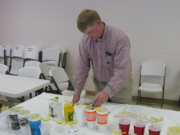 John W. Smith (AgriLife Extension), Private Water Well Screening Event, Granbury, Texas, June 2009; photo courtesy of Marty Vahlenkamp (AgriLife Extension)
Well Maintenance
- Tex*A*Syst "Reducing Contamination by Improving Wellhead Management and Conditions"
- Wellowner.org provides information regarding Water Well Maintenance.
- TCEQ's Disinfecting Your Private Well (PDF. Help with PDF.)
- How To Disinfect A Private Well System; additional translations are also available (PDF. Help with PDF.)
Testing Private Wells
- TCEQ's How to Sample for Bacteriological Contaminants in Your Private Well Water (PDF. Help with PDF.)
- TCEQ's List of Accredited Laboratories Available for Microbial Testing
- EPA's Private Drinking Water Wells Page
- Center for Disease Control's Private Well Resources
- If a well is located in a groundwater district, sometimes the district can provide testing services or resources. See the Texas Alliance of Groundwater Districts for information.
- Wellowner.org provides information regarding Water Quality & Quantity and testing.
The Texas A&M AgriLife Extension Service on-line Bookstore offers a number of publications on drinking water contamination (e.g., lead, arsenic, copper, nitrates, radionuclides, etc.), as well as introductory fact sheets such as "Solving Water Quality Problems in the Home" (L-5450) and "What's In My Water?" (E-176). Hard copies or free electronic downloads of these publications are available after setting up an account.
Industrial Wells
- Railroad Commission of Texas (RRC) regulates oil and gas industry wells.
Well Contamination
There are several ways a well can become contaminated. Toxic material spilled or dumped near a well can leach into the aquifer
and contaminate the groundwater drawn from a well. Polluted water can leak through the walls of poorly maintained or shoddily
constructed wells. Wells can get contaminated from septic tanks placed too close or abandoned wells in the area. Flood events
can also impact the quality of well water.
Well owners can protect themselves from contamination in several ways, such as preventing pollution in the aquifer and
maintaining proper well practices. The first step in preventing well contamination is education. We hope these links help.
- TGPC's Groundwater Contamination Page
- Tex*A*Syst "Reducing Contamination by Improving Wellhead Management and Conditions"
- EPA's National Water Quality Standards Database
- EPA's Private Drinking Water Wells Page
- Texas Alliance of Groundwater Districts
Drilling a Well
Poor construction or maintenance of a well can severely effect its longevity and water quality. The Texas Groundwater Protection Committee recommends that citizens use professional, licensed water well drillers and pump installers for constructing and maintaining a well. While the state can not guarantee the work of any drilling and pump business, the licensing of professionals helps hold professional drillers and installers accountable for their work, encourage high technical standards, and promote quality construction. The Texas Department of Licensing and Regulation (TDLR) investigates citizen's drilling complaints and maintains a database of licensed drillers and pump installers:
- Click on “Search Everything” at the top center of the TDLR home page, then click on the link for “Search for Individuals and Businesses” under the License Search heading.
- Select “Water Well Drillers, Pump Installers” from the Inquire by License Type pulldown menu, and any other qualifying information, and then click on “Search”.
Regardless of who drills a well, constructions standards and Groundwater Conservation District (GCD) rules must be followed. A licensed driller will take responsibility and liability for the constructions standards and will usually be knowledgeable of GCD requirements. However, the landowner is also responsible for abiding by GCD policies and should become familiar with their new well-owner responsibilities.
- TDLR's Water Well Drillers and Pump Installers Program contains information on well specifications, well reports, the licensing of well drillers and pump installers, and reporting construction violations.
- TDLR provides Well Construction and Plugging Specifications.
- The Railroad Commission of Texas Groundwater Advisory Unit provides groundwater protection determination letters.
- Links to the Statewide Water Well Databases can be found on the TGPC's Water Wells webpage under the Well Basics heading.
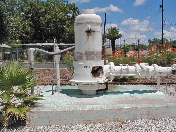 A public water supply wellhead in San Antonio, TX; photo courtesy of Alan Cherepon (TCEQ)
 Public Wells
Public wells serve public water supply systems and are regulated by the Public Drinking Water Section of the TCEQ. These public water supply systems must have at least 15 service connections or serve at least 25 individuals at least 60 days out of the year.
- TCEQ's Public Drinking Water Section regulates public water supply systems
- TCEQ's Consumer Confidence Reports (CCR) Page. CCR's are annual water reports from community water supplies.
- Texas Rural Water Association is a statewide nonprofit educational and trade association.
- TWDB's Clean Water State Revolving Fund (CWSRF) Loan Program provides loans at interest rates lower than market rate to governmental entities for water infrastructure projects.
- National Drinking Water Clearinghouse provides assistance to small communities on drinking water issues.
- American Water Works Association assists water supply professionals with information and resources.
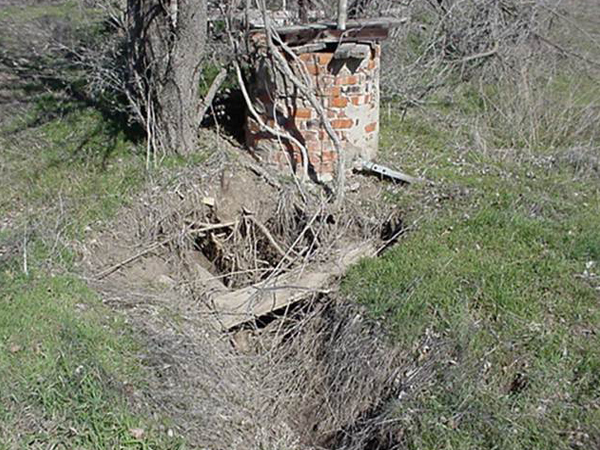 Abandoned water well; photo courtesy of David Gunn (TDLR)
 Abandoned Wells
Abandoned wells are a threat to well water and public safety. Abandoned wells provide a direct channel for contaminants to pollute the aquifer below. Contaminants that enter a well are introduced directly into the aquifer with no opportunity for natural filtration by soils or geologic materials.
Abandoned wells also present the possibility that a humans or animals can fall into the unplugged wells and suffer injury or death. Texas law makes the landowner responsible for plugging abandoned wells and liable for any water contamination or injury.
- TGPC's Landowner's Guide to Plugging Abandoned Water Wells
- Texas A&M AgriLife Extension Service's Abandoned Well Plugging
- The Texas A&M AgriLife Extension Service on-line Bookstore offers a number of publications on abandoned water wells such as "Plugging Abandoned Water Wells" (B-6238) and "Capping of Water Wells for Future Use" (L-5490). Hard copies or free electronic downloads of these publications are available after setting up an account.
- TDLR's Water Well Drillers and Pump Installers Technical Guidance on Abandoned or Deteriorated Water Wells
- TDLR's Well Construction and Plugging Specifications
- TDLR's Abandoned Well Determination Checklist
- RRC's Federally Funded Well Plugging and State Managed Well Plugging for oil and gas industry wells
Possible Funding Resources
- Technical and financial assistance are available to landowners to address resource concerns through the U.S. Department of Agriculture (USDA) Natural Resources Conservation Service (NRCS). Water well decommissioning is an available conservation practice. For more information, please see their Well Decommissioning Conservation Practice Standard or contact a USDA NRCS conservationist at your local USDA Service Center.
- The Texas Alliance of Groundwater Districts has an online Viewer (GCD Index) which provides detailed information about the state's Groundwater Conservation Districts (GCDs). Below is a map of the GCDs with cost share programs for plugging abandoned water wells based on 2023 GCD Index data. Note that map layer boundaries have been simplified for display purposes. A summary of these GCDs with plugging programs is available.
- Pan and zoom the map to the area of interest, then click a brightly colored GCD for its program summary and contact information. If desired, click the URL, and then click the URL again in the new browser tab to confirm the redirect. Click the back arrow on the left side of the red banner to close the pop-up.
- The icon on the left side of the black banner opens and closes the map legend. The arrow on the left side of the text at the top of the legend expands and collapses the map details. The box in the bottom left corner of the legend switches the base map between roads and satellite view. The icon on the right side of the black banner opens the map in a new browser tab.